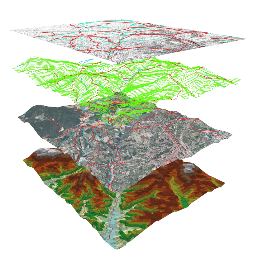
DIGITAL MAPPING AND DATA ACQUISITION


Through the use of our comprehensive in-house resources, we can acquire data in the most ef cient possible to serve as the foundation of your GIS. Whether the acquisition will populate to a new GIS or update an existing GIS system as data is the fuel of any GIS. Through out our in house application tools GPS for GIS data collection become part of the circle. Mobility GIS collection become our main compo- nent during the data acquisition. We have experience in collecting comprehensive Asset Management Mapping such as Streetlight, Road Furniture, Urban Trees Mapping and Underground Utility Cable and Piping Network. Our ESRI con guration technology enhances the quality and speed whether in running on two different platforms which are Windows or Android usage.


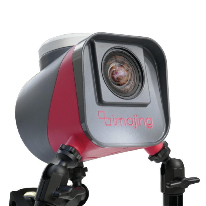
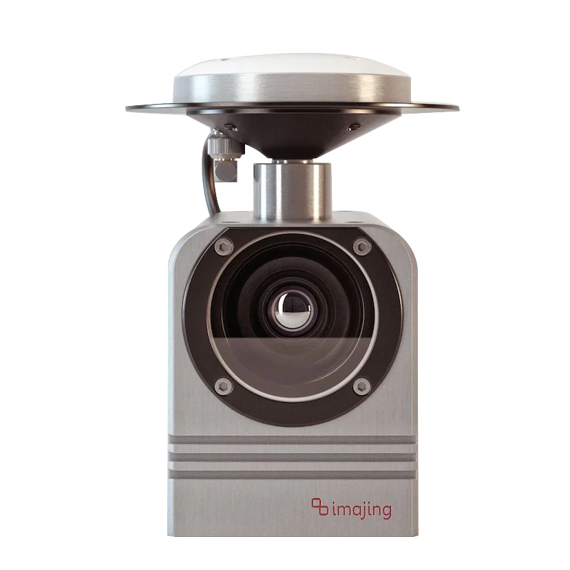
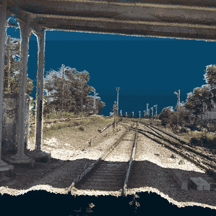
We also provide streetview data collection using streetview 360°  car camera. The Camera System is a complete solution for fixed mounting. This ready-to-use 360°  degree panorama GPS Camera System is ideal for your professional imaging needs.


The Applied Streetview Camera System is the turn-key solution for 360° ​​​​​​​ degree panorama surveys and documentation. It helps your decision making processes such as


• Inventories


• Maintenance procedures


• Quality control


• Documentation of state of construction Construction planning


• Documentation of construction environmental impact studies


IMAJING MOBILE MAPPING TECHNOLOGY


We provide France-made Mobile Mapping Systems; - Imajing camera. This system are the combination of various navigation and remote sensing technologies on a common moving platform. They are capable of providing fast, efficient and complete data collection. There are often three main components in MMS: positioning system, camera(s) and lidar.The positioning is done through GPS/GNSS and inertial measurement units. By using these systems, the data can be recorded continuously and accurately.


The images recorded are taken through the use of RGB cameras that are equipped with a CMOS global shutter or CCD sensor through which the colored images of persons and objects are acquired. Lidar, Light Detection and Ranging, is a remote sensing method that uses light in the form of pulsed laser to measure ranges to the Earth.


This technology is already used in road and rail maintenance, mapping projects and to improve the safety of infrastructures.


The imajbox® technology integrates all of these concepts and delivers the information needed on a very large scale, at a minimized operational, computing and storage cost. As a consequence, running regular surveys becomes affordable when using imajing technologies, enabling new approaches in network monitoring and change detection.

  • ima1.png
  • ima2.png
  • ima4.jpg

Sky-Shine Corporation carries highly recognized brands :​​​​​​​