Maxar Intelligence 

Maxar Intelligence serves with the most discriminating and innovative customers on the planet. We deliver breakthrough technology and insights to unlock infinite possibilities for a better world.


Grounded in our values, the Maxar Intelligence leadership team is committed to serving our customers and communities all over the globe and brings together industry leading experience to accelerate our innovation forward At every opportunity we seek to harness our capabilities for a better world. This not only means improving our own technological processes and outputs but connecting visionaries—big and small—with the information, infrastructure and services they need to succeed.

Maxar Intelligence proudly delivers on the promise of truth and transparency from space. We own and operate the world’s most sophisticated constellation of Earth imaging satellites. With five active satellites on orbit, we collect more than 3 million square kilometers of imagery each day to provide customers with a current view of our changing planet.

EXPLORE


Design, build and deploy resilient space infrastructure for any mission

CONNECT


Deploy cutting-edge systems for communications and data from or across space

ACCESS


Identify, understand and address change with accurate geospatial information

MAP


Create and customize maps with professional-grade imagery mosaics and information layers

ANALYZE


Reveal patterns, detect objects and extract geospatial insight at scale

AUSTRALIA WILDFIRES


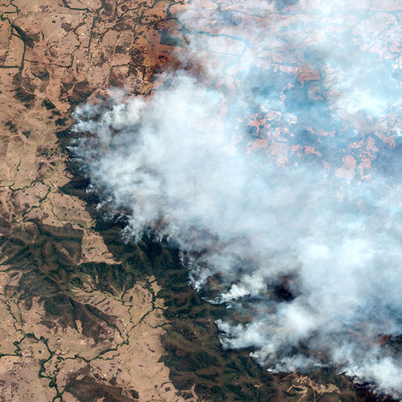
Record-breaking temperatures and months of severe drought have fueled a series of massive bushfires across Australia. New South Wales has been the worst-hit state so far, with more than 12 million acres and 1,300 homes burned. Thousands of people are seeking shelter from the fires. Approximately 130 fires are burning in the bush, mountain forests and national parks throughout the state as of January 15, 2020. Due to the prolonged drought and strong winds, conditions are primed for the fire to spread rapidly. To put the New South Wales fire damage into perspective, about 2.2 million acres were lost in the 2019 Amazon fires and around 1.9 million acres were burned in the 2018 California wildfires. Maxar’s Open Data Program imagery efforts will be focusing on New South Wales as this area has been hit the hardest.