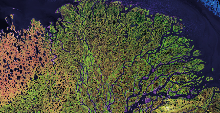
We are the leading provider of advanced geospatial information products and services derived from the High Resolution (Maxar Technologies) Optical Satellite Imagery, Satellite Borne (RADARsat), Airborne Radar (IFSAR) data and LIDAR. Our extensive experience in successfully delivering information solutions for complex and demanding operations support has made us the primary source used by the Oil and Gas, Land and Maritime Surveillance, National Mapping, Aeronautical Information and Precision Farming markets.
Our expanding worldwide client base is a result of our commitment to our clients by providing innovative solutions and the highest quality service.
With good long business partner relationship between DigitalGLobe and Sky-Shine Corporation, we entitled to become their business partner in Malaysia from the first launch of their satellite (QuickBird) in the year 2002 until today. To date there are another 6 satellites that are WorldView 1, WorldView 2, WorldView 3, WorldView 4, GeoEye 1, and Ikonos which are currently active to support the amount of high resolution satellite imagery needs throughout our country. We are the only geospatial data provider company in Malaysia capable to provide and made usage of 7 high resolution satellites (sub-meter pixel resolution) that are active and having 16 Bands Spectrum Imagery data for any kind of remote sensing application requirement.
In the Year 2010, we are being appointed as Master Distributor for supplying RadarSat. 1 and RadarSat. 2 Satellite Imagery from MacDonald, Dettwiler and Associates Ltd (MDA) in Malaysia. Radar Image uses a Synthetic Aperture Radar (SAR) sensor to image the earth using microwave frequency. Unlike optical satellite that sense re ected sunlight, SAR system transmit microwave energy towards the surface and record the re ections. Thus, Radar image can image the earth, day or night in any atmospheric condition such cloud cover, dust or haze. Both satellites provide dierent beam modes and dierent image solution as subject to coverage, resolution and cost. For this Active Satellite Sensor such radar is useful for maritime surveillance, sheries and critical mission application.From year 2013 until 2015, we have completed topographic mapping using RadarSat2 with 5 meter RMSE accuracy for whole Peninsular Malaysia, Sabah and Sarawak.
In year 2017, MDA, SSL, DigitalGlobe and Radiant Solutions are merge as MAXAR Technologies. So with this merging, Sky-Shine is the distributor for all MAXAR Technologies product. For the commitment to the Airborne Sensor Imagery sector, together with Intermap Technologies Inc, we at Sky-Shine Corporation able to provide IFSAR and LIDAR data respectively to the end user requirement. Airborne Sensor data are more accurate position compare to the satellite sensor borne data. This type of data is very useful for users that concern accuracy is the top priority. Both sensors have their market business industry that comply each other. Interferometric Synthetic Aperture Radar (IFSAR) is a radar technique that attach as Air Borne Sensor. At Sky-Shine Corporation together with good relationship with Intermap Technologies Inc we able to provide the best available of the shelf 3D Terrain Information (Digital Elevation Model) for Malaysia in term of Digital Surface Model and Digital Terrain Model for the usage of Energy Application, Engineering Application, Telecommunication Application and Flood Plan Management.
LIDAR, acronym for “Light Detection and Ranging “, is another airborne sensor technology that measures properties of scattered light to nd range of a distant target. LIDAR data is very precise compare to IFSAR data. This technology oers one of the most accurate, expedient and cost-eective ways to capture elevation information. LIDAR data is directly processed to produce detailed bare earth models in a variety of formats including LAS, ASCII, ESRI and CAD. Typical horizontal accuracies range between 15.0 cm to 100.0 cm. Typical vertical accuracies range between 9.24 cm and 18.5 cm for xed wing aircraft. Mostly Lidar is widely used for high accuracy demand sector such Digital Elevation Model and Building Footprint marking and Height Measurement or any application that precise demanding.
UNMANNED AERIAL VEHICLE (UAV)
Unmanned Aerial Vehicle (UAV) Sky-Shine has added the capability to collect/Sell high-resolution imagery from a small, Unmanned Aerial Vehicle (UAV). We have two brand UAV which is Heliceo and DJI. Heliceo is the latest technology from France, The system is safe, ecient and costcompetitive in comparison to traditional Fixed- wing / helicopter-based data collection platforms and terrestrial survey operations. The collected imagery can be eciently processed to generate digital surface models, topography and imagery data products to integrate into both CAD and GIS systems. Helecio professional commercial UAS / UAV / Drones are today performing missions of surveying, mapping, city-planning, mining, forestry, agriculture, volume calculations, science, wildlife protection and much more. A complete aerial geomatics, geospatial technology, equipment platform for georeferenced orthophotography and 3D modelling. Prepared for use with multiple sensors, ranging from e.g. cameras to thermal imaging, multi and hyper spectral, lidar and magnetometer. The production of Digital Terrain Models, DTM and Digital Surface Models, DSM, for Geographic Information Systems, GIS, is done through partner software like e.g. Pix4d and Agisoft.
By 2020, Sky-Shine has been appointed as resellers of DJI Drone in Malaysia. We carry DJI product such as Mavic, Phantom, Matrice, and Inspire. Creativity is at the heart of every dream. Every idea, every groundbreaking leap that changes the world starts with the vision of talented creators. At DJI, they give these creators the tools they need to bring their ideas to life. DJI platforms empower them to capture images that were once out of reach. Their flying and camera stabilization systems redefine camera placement and motion. Amazing photos and video, treasured personal memories, and high-end professional imagery are captured every day, in every corner of the world using DJI products. They do this through an unparalleled commitment to R&D, a culture of constant innovation and curiosity, and a focus on transforming complex technology into easy-to-use devices. Building on the ethos of “form follows function,” our products combine advanced technology with dynamic designs.
IMAJING MOBILE MAPPING TECHNOLOGY
Mobile Mapping Systems are the combination of various navigation and remote sensing technologies on a common moving platform. They are capable of providing fast, efficient and complete data collection. There are often three main components in MMS: positioning system, camera(s) and lidar.
The positioning is done through GPS/ GNSS and inertial measurement units. By using these systems, the data can be recorded continuously and accurately.
The images recorded are taken through the use of RGB cameras that are equipped with a CMOS global shutter or CCD sensor through which the colored images of persons and objects are acquired. Lidar, Light Detection and Ranging, is a remote sensing method that uses light in the form of pulsed laser to measure ranges to the Earth In recent years, it has become one of, if not the, most important geospatial technologies available. Areas that are inaccessible can be mapped effectively thanks to the mobility of the platforms and areas that would have taken weeks to survey can now be done in only a few days.

